Just Like Scout Camp, only better

May 14,2018

I’ll be leading almost 30 boys to Scout camp in mid-June, so what I’ve done the past two days might serve as good preparation.
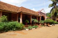
For one thing, we ate common meals at the Lodge. Admittedly, there was no Paul Bunyan breakfast (thankfully!); instead, we had buffets that included a lot of Indian food. Part of the explanation for the Uganda Chapati and Dal and baked on the spot in a tandoor oven nan (!) is the Indian influence that started in the British period; even more helpful in understanding the fare is that the Lodge is owned by the richest Indian in Uganda. And, as we stop at historic Galena on our way home from camp, we stopped for lunch at a restaurant hotel built by the Kenya Uganda Railway and Harbours in 1923. That hotel had as guests Humphrey Bogart and Kathrine Hepburn during the filming of The African Queen.
Speaking of the African Queen, Sunday morning we continued our waterfront activities (we had a few hours downtime Saturday; I did laps in the pool. Several others discovered that being near the equator and in the sun can be a painful experience). While swimming in the Nile might have been attractive, one look at the 14 foot crocs lining the shore and remembering Captain Hook, and the herds of hippos, the animal that kills more Africans than any non-human animal, left me thinking I’ll do the mile swim at camp instead.
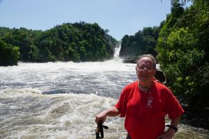
We went upriver on the African Queen (you knew at some point there was a reason to mention the movie; not THE African Queen, but An African Queen) to Murchison Falls (Headline: Murchison Falls but no one was hurt), the 200 or so foot high waterfall that gives the park its name. Docking near the falls, we hiked about 2 miles to the summit where we could overlook the falls, a powerful cascade that is one of many obstacles on the river’s journey to the delta around Alexandria. That was our hike for the day.
Returning to the Lodge, we had a speaker from the Uganda Wildlife Administration, who told us something about the history of conservation in Uganda, and the challenges he faces in running the area. Conservation/tourism is important to the economy (it’s the biggest business in the world); ¼ of the nation is in either national parks or reservations. Ironically, in the 1950s, Uganda’s parks had more visitors than any other park in Africa. The disastrous poaching civil wars, as I mentioned, killed people and animals. For example, the herd of 14000 elephants dwindled to 300; it’s now about 1400. One challenge to this park is that commercially viable oil deposits have been found under the park, and, like so many similar areas around the world, the extraction (if it happens) needs to be monitored carefully. He described meetings and agreements that were designed to extract but protect; one feature I remembered is that a pipeline connected to a refinery would have to be underground—those same elephants would crush it. He also discussed, and we ran across an armed patrol on one of our game drives. He said it’s become less of a problem because many countries have banned the importation of ivory.
On our way back to Kampala, we got another taste of the biodiversity of Murchison Falls National Park, and we continued to work on our Mammals, Nature and Environmental Science badges with a visit to a jungle for a chimpanzee trek. Donning rubber boots, we plunged into a dense jungle; the object—the sighting of our closest relatives. For about an hour, our guide took us through the brush looking for the chimps. I was afraid all we’d get for our troubles were pictures of knuckle prints on the ground (that’s how they travel). Suddenly I heard a racket that I thought was some inconsiderate student group—that’s what it sounded like. There was also a thump, like a chimpanzee thumping his chest. We headed toward where the guide thought they were moving, when, lo and behold, we spotted three or four. One ran across the floor of the jungle in front of us, and when I get the video, I’ll put it on Facebook, but spent the better part of the next two hours, craning to get a glimpse of the mammals in the treetops. You could tell where they were from moving branches, falling leaves, and the sounds.
I saw a little one. You might say he was a chimp off the old block. Oh, you don’t have to. I did.

A Nile High

May 12, 2018
Being Nile High
As I warned, we are in de Nile, or rather in sight of de Nile, the Victoria Nile (one of the major branches) at Murchison Falls National Park, at 2400 square miles, the largest preserve in Uganda.
It wasn’t always so. Though it was originally set up in 1910, its checkered history included a staging ground as part of the civil wars (it’s close to the border with Congo), at which time many of the animals were slaughtered. The park has rebuilt populations, partly with imports from other countries, mostly Kenya, and culled a rampant and destructive elephant herd. Currently, it has large numbers of giraffes, elephants, monkeys (we have a resident baboon on the hotel grounds who scatters when he sees the maintenance people, but boldly steals from guests; she—it’s a whole baboon family including a really photogenic baby—pilfered a bagged lunch from a table and proceeded to rip it open and devour the food) and other members of what I call the vegetarians—lovers of the grassland and the trees that dot the open savannah. Perhaps the most pronounced feature of the savannah is the sense of space, the expanse stretching as far as the eye can see.
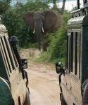
This morning was a “game drive,” starting at 6:15 and lasting until around 10 o’clock that had us over hill and dale, in Land Cruisers (we had to stay on the road) peering into the distance—or up close—for the kobs and Jackson’s hartebeests, water buffalos of various varieties, the elephants, hyenas, and jackals that make the park home. One group spotted a baby leopard, but as I said, we saw mostly the vegetarians, peacefully but warily coexisting. The evening was better since It was partly along the Nile, and the giraffes and elephants in particular came for a drink (the local beer is, naturally, Nile, and as someone quipped, “It’s Nile time.”) It was a little scary driving back in the dark over bumpy roads in an open Land Cruiser.
This was my eighth or so game drive, and as I remarked to Mike Shealy, the logistic director of the trip, it never gets old; more than that, it’s a real high (at least a Nile high?)—watching giraffes munching on leaves, then walking left right left (both right legs move then both left legs move), or watching the semi-predators, the hyenas and jackals, circle and await an opportunity to strike.
To get here (and stay in a lodge that gets high marks for “bush” architecture), it took us almost 8 hours to traverse the 150 miles. That’s as the crow flies, though, and we were driving. About an hour of that was getting out of the sprawling city of Kampala (though it did take us thorough the delightful embassy area), and part of it was waiting for the ferry to cross the Nile. Part of it (the last 45 miles or so was on dirt roads, which verified what we’d been told in Kampala—Uganda has infrastructure problems, particularly in the North.
On the way, we drove through a lot of small towns; only 10% of the population lives in the Kampala Entebbe corridor. Interestingly enough, many of them had mosques or madrassas; one of the South Carolina faculty told me he was researching the increasing Arabic financing in Africa—Abu Dabi airfare is under $300 from here.
Second, we saw agriculture that was mostly manual—I saw only two tractors, and one Cat grader—and no horses or cows, though our driver said that in the planting season, cows pull plows. The coops were mostly bananas, and, evoking nostalgia, corn.
Third, we stopped at a white rhinoceros sanctuary. The rhinos were exterminated from Uganda during the wars, No doubt poaching played a role; rhino horns are in great demand in Asia as an aphrodisiac. I’ve been told ground rhino horn costs three times as much as gold.
Rhinos fared better here because interested citizens formed an NGO to reestablish their presence here. Around 2004, they got one from Kenya and one from the United States; their child, the first of what is now a “crash” (take a crash course and look it up in the dictionary) of 22, was named “Obama.” The goal is to have around 40 so they can release them to the parks.
During the civil war, both people and animals suffered; from what we have seen, both are recovering.

Almost in De Nile

3-5-10
Announcing that business Uganda could be summed up in those three numbers, a member of the State Department spent about two hours with us at the formidable US embassy in Kampala.
The 3% referred to the population growth in Uganda. I said it’s about 40 million; that would make it 80 million in 24 years. Furthermore, it’s a young population; the median age is 15.7; only 2% of the population is 65 or over.
The 5% alluded to the urban growth. Though the country is still 80% involved in agriculture, urbanization is growing quickly. (take it from me, the sprawling distance from Entebbe, where the airport is located, to Kampala certainly indicates urbanization in this area; it’s almost solid construction. It took us about 1 1//2 hours from the airport, though the Chinese are building a highway that will cut it to half an hour)
The 10% was the number of new cars purchased each year, which is both a strength (an indicator that despite the average income of $700 a year, there is an emerging middle class) and a weakness (sketchy infrastructure and traffic jams). I was struck as we came in at night by the number of trucks alongside the highway, waiting to carry goods during the day.
He then dissected the economy’s opportunities and weaknesses.
On the plus side, he singled out a good climate, and fertile soil. This is an important agricultural area, and, in fact, the main export crop is coffee. 4.5 million bags were shipped last year, making Uganda the largest exporter of coffee in Africa; Ethiopia and Kenya grow more, but also drink more. The crop here is sold to Starbucks (arabica) and to the European Union (robusta). He emphasized, however, that coffee is also something of a minus. It’s shipped out as a commodity, without any value added (e.g., roasting?). I saw somewhere that the difference in cost between the raw beans and the roasted beans was over 50%. If you sell commodities, you’re at the mercy of lowest cost providers, and what money can be made, goes to the folks who add value.
Another agricultural product with potential is milk, but not as milk. Milk is cheap here (20 cents a liter), but turned into casein, it commands premium prices. Another way to add value.
The same scenario holds for oil. Ugandans recently discovered oil, and an American consortium recently landed a $3 billion contract to build a refinery. That’s the first refinery in the country (I believe), and another opportunity for value added activities, and a chance to earn more on the supply chain.
The other big opportunity is to participate more in the world’s biggest business—tourism.
He touched, too, on many of the same drawbacks we’d heard about earlier: infrastructure (or lack thereof); corruption (a relatively stable government, but an underpaid civil service). He said the goal of the US government is to insist on a level playing field, but some bids are rigged, and while there are laws and regulations, sometimes the laws are contradictory—allowing the official to make his choice of which one to follow—and sometimes ignored, for a price.
He, too, emphasized the need to be “on the ground” for a while to learn the rules of the game and how it’s played. He thought that was one difference between the Americans and Chinese. While the Chinese presence in Uganda is not as prominent as it is in Ethiopia (where there were 1 million Chinese reportedly when I was there two years ago), there are 15,000 working on infrastructure projects. The Chinese, he pointed out, come in prepared with the whole package, we’ll have someone on site to make sure it happens, with financing, and as he noted with not a sign of irony, the Chinese are used to dealing with authoritarian governments.
American strengths were in “good will” established by previous presidents from Bush through Obama. There’s a Young African leaders program that sends 1000 Africans to the States for 6 weeks, spent mostly at universities that’s been a real positive; assistance in fighting AIDS and other health epidemics was also a plus. And the US government does assist businesses who want to come to Uganda, or do business with companies in Uganda.
In fact, we just had a reception hosted by the American Chamber of Commerce where the Ambassador spoke, just having returned from a trip to the States which included 20 coffee producers shepherded to a conference. She noted that only 3% of Ugandan coffee is exported to the United States.
Among the other members of the chamber, I chatted with the vice president, a woman who came here (via Silicon Valley) to work in agriculture, at the time pioneering organically grown fruits and vegetables. She told me that over 40% of the crop rotted because it could not get to market. She’s developed a supply chain of farmers, working with a certifying organization, to buy and dehydrate the crops, which she sells to distributors in the United States. When asked about changes in five years, she gave me two: the exchange rate has gone up (her dollars buy more shillings), and the business has gotten more competitive. Not only has “organic” become more mainstream, but neighboring countries have developed processing and are able to buy here and process across the border. I talked her into some treats for the long ride to the source of the Nile tomorrow—and I’m eager to taste dried Jackfruit! Another tidbit—she said she was invited to come here by one of the queens (yes, the five kingdoms still live!)
I’m about to pack for our early departure, and I’ve realized the title is 3/5/10, and there’s some nice symmetry that today is 5/10. Heading to the area north of the Nile. Soon we’ll be in de Nile.

The Lion Sleeps Tonight (but not in Kampala)

May 9, 2018
This was Lion country (but not today)
00 19 says my GPS, referring to Kampala, the capital of Uganda. It’s 7824 miles from home—or about 27 hours by plane (via Atlanta and Amsterdam), just north of the Equator.
Three street names near the hotel help me put the history of Uganda into perspective. The first is “Entebbe”, a word in the Luganda language that means “seal’, supposedly in reference to the court that for 500 years administered judgments on behalf of the well-organized Bugunda tribe. The centralized government created a strong state in what is now southern Uganda that the British used to rule, as the British were wont to do, indirectly. No such unity existed in the north and the northern and southern parts of the country still maintain differences, the south being better developed economically.
The second street is George VI, king of England, whose country claimed Uganda in the 19th century as part of the Congress of Berlin. Britain’s main area of interest was the Suez Canal (opened in 1869 accompanied by Verdi’s Aida). As 19th century explorers sought the source of the Nile (we’ll see it next week), the Germans got a treaty to parts of the area; Britain swapped Heligoland to the Germans for the Uganda Protectorate, a kind of federation of 56 tribes, 5 kingdoms under British “supervision”.
Unlike most other British colonies, Africans could own land; like other British colonies, the British played one ethnic group against another. 40000 Indians arrived at the turn of the century to help build a railroad from land-locked Kampala to the coast. 2000 died from fever—and lion attacks (hence, the title today); the lions are gone, at least from this city of nearly 2 million people. So, mostly is the rail traffic. The station remains, serving mostly domestic traffic because the tracks were stolen for steel (steel was stolen?) and the gauge was non-standard. However, English is spoken widely (one legacy), and the currency is the shilling (another), .plus there is a Parliament.
The third street is named for Nasser, the Egyptian ruler, who helped topple King Farouk and the British indirect rule in Egypt. That (and the success of the Chinese revolution and the spread of the Cold War around the world) helped convince African nationalists to push for independence. That happened here in October 1962, which ushered in a turbulence that has left its mark to this day.
For one thing, the British used mostly Northerners in the military; and if you’re old enough to remember Idi Amin, he was a northerner who “moved to the Left”, resulting in 300,000 dead (if you criticized, you were done); the enforced departure of all Asians, crippled the economy since Asians dominated businesses, paying up to 90% of the taxes.
Several civil wars later (today), Uganda has a population of 43 million, with an average formal income of around $700. Much of the income is “informal”, partly because of the difficulty of doing business here. We got to see the local market, a fascinating open air “Saturday market” type, with farmers bringing produce to the city—bananas, mangos, potatoes, garlic, and some not so Western additions: I liked the fried grasshoppers, as well as the usual pigs, cattle, etc. With so much of the economy informal, it’s not surprising that there were government sponsored posters “Thanks for paying your taxes so we could pay for schools, etc.
We had a few speakers from the American Chamber of Commerce talk about doing here business here, -one a Quad Cities UIowa grad, who has been here 5 years , and sounds like he runs about 10 businesses. He talked about the great opportunities for entrepreneurs, despite the fact that the corruption ranks 150 of 179 countries; the lack of infrastructure; the bureaucracy in starting and maintaining a business; and the fact that employees get paid by you while working to start and run their own businesses.
I think his point was that you need to be on the ground to understand how to do business in any country, especially here. “That’s just the way it is here,” he repeated several times.
More inspirational was a fund manager from Impact Africa, whose goal is to put money into organizations that result in economic, political, or social improvements. I took lots of notes on her presentation to share with my classes—IWU president Myers used to say, “Go forth and make good—and do good” and her talk insisted it was possible to do both—and make money. One of the faculty and I were discussing how mission statements have changed from “make money for shareholders” to “feed the world.”
I’m taking the notes to my stockbroker too. Both the lion and I will sleep tonight.

East Side, West Side, all around Berlin

March 15, 2018
While “East Side, West Side, all around the town” was written about New York City, probably no city in the world would have a better claim to East and West than Berlin, which was actually both really and symbolically severed into Eastern and Western zones from the end of World War II until the end of 1989.
Shades of the cold war, two world wars, the Weimar Republic, the First, Second, and Third Reichs still mark the history of the city, which is both reasonably far north (52 degrees) and East in Europe.
We’re at the Adlon Hotel, a rebuilt five-star attraction in sight of the Brandenburg Gate, one of the former gates to the city of Berlin—and perhaps the most important, since the political development of Berlin originated in the Elector of Brandenburg, a member of the House of Hohenzollern. The “mother church” of the Hohenzollerns was in East Prussia, and the Kings in Prussia (beginning in 1701 and ending with Wilhelm II in 1888) were crowned in Konigsburg, now the Russian Kaliningrad.
Berlin has been settled a long time, but it’s importance has grown under one of my favorite kings, Frederick the Great (of course), who made major strides in integrating Prussia into Europe (wars expanded the kingdom westward) and got his title changed to King of Prussia.
We spent about half of yesterday touring Berlin proper, and about half of the rest of the day in Potsdam, where the Hohenzollerns built most of their 40 local castles. The city proper still has remnants of the bitter fighting in April 1945, when Hitler, in a last gasp of megalomania ordered his soldiers to fight to the death. There are bullet holes remaining in some of the buildings in Berlin. Some of the “highlights” were destroyed in World War II, (including the city palace, now being rebuilt) or were left (particularly by the Soviet-East Germans) to fall into disrepair, so that they could build East Germany into a “Worker’s Paradise”. That was the fate of the Spandau prison, for example.
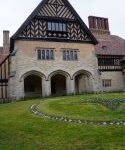
Ironically, the palaces in Potsdam escaped major damage, which was one reason why the last of the “wartime conferences” –with the revamped Big Three (Stalin, Truman, and Churchill—replaced midway by Clement Atlee, the Labor leader whose party won an election)—met for the “Big Three” conference that has come to be called Potsdam. The palace built in the early 20th century for the Crown Prince (looking for all the world like the Ewing Manor, but about 20X the size) is English Tudor, reflecting the love-hate relationship the Hohenzollerns had with their Windsor cousins, who sat on the throne in England. There’s a large table in a room with, happily, three equal sized doors, so each country could have an equal entrance (but the flags rotated from day to day so that no single flag stayed in the center) where the participants met, and decided, among other things, on the partition of Germany and Poland, and the denazification of Germany. I hadn’t been to that palace before, and was a little surprised to learn that the Crown Prince came back to Germany after 1918, and flirted with Hitler (who toyed with restoring the monarchy), and lived in the palace until the threat from Soviet troops led him to flee. One of the royal relatives, too, died in Windhoeck, (now Namibia), where there’s still a German presence.
The most complete of the palaces is the summer palace of Frederick the Great, the well-named San Souci (carefree), where he would retire for the summer, and play his flute (he composed concerti), converse with Voltaire in French (he spoke German, he said, only to his horses), and discuss philosophy with the philosophes—when not making war, particularly on Maria Theresa of Austria (he coveted Silesia, with its industrial potential!). His father had bequeathed him a military establishment that was the envy of Europe, and enough money to build a rococo palace that is still one of the major attractions of Berlin. Tours are costly (about $25), and limited to a certain number of guests a day. It really is a stunning look at paintings and décor of the period.
The other palace open during the winter in Potsdam is being renovated. It was where Wilhelm II, the last Kaiser, lived. When he left it in 1918 (he abdicated and moved to the Netherlands), he apparently took all the furniture with him. I remember the rooms as sumptuous, but relatively empty.
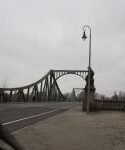
On the road to Potsdam, we drove over another reminder of the Cold War—the bridge of spies, which was the border between East and West. There were at least three exchanges of spies there—subsequently made into a movie—including, if I remember it correctly, Gary Powers, who was shot down in a spy plane over the Soviet Union (my fraternity for a time created a position for a spy plane pilot).
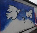
The Cold War in the city is captured best in the remnants of the Berlin Wall. Our guide, who had grown up in East Berlin, talked about the effort of the Russians to showcase East Berlin. The East sector, ironically, got many of the traditional tourist sights (the Museums, State Opera, etc.) Unfortunately for the East German communists (the party incidentally still exists and is headquartered in a posh building in Potsdam, not fit for a proletariat!), life in the West was so much more attractive that in 1961, the East German government erected a wall to keep East Germans from fleeing. In the next almost 30 years, over 1000 East Germans died trying to escape. Parts of the wall still exist, covered with approved artistic graffiti.
The other remnant of the Cold War was Checkpoint Charlie, one of three crossing points between East and the US Zone. The others were Able and Baker. (ABC) The Checkpoint is manned by “soldiers” in US uniform (East Europeans snickered our guide), who for a 3 Euro “gift” will let you take pictures with them. Though the wall is down, some things in Berlin never change.

Museums and Palaces in Berlin

March 18, 2018
If you’re thinking our trip was mostly museums and palaces, it’s even less diversified than it sounds; most of the palaces, no longer occupied by Hohenzollerns, ARE museums. And that was even true of our last night’s visit to Charlottenburg, the palace built in what was then the outskirts of the city (the far side of the hunting park -today the Tiergarten-that extends west from the Brandenburg Gate. The palace, the largest in what is now Berlin, was built originally in the late 17th century by one of the Fredericks (or Williams; or Frederick Williams—the Hohenzollerns tended to one of other, or both names) for his wife, Sophie Charlotte. The dome of the palace can be seen for miles, and the gate to the city (now district) of Charlottenburg rivals the Brandenburg Gate. The palace grounds are also well worth a visit, though, as is typical of much of Berlin, major parts of the palace were rebuilt after being bombed in World War II.
Anyway, we had dinner in the palace, followed by a concert in the Orangerie, a room that was probably where the Frederick/Williams of the world held their chamber music concerts for guests. The sound (and setting) made it clear that this is how one should listen to chamber music, such as the Vivaldi/Handel concert we heard. The musicians were in period costume, though the white wigs clashed (for me) with their black beards. The room was cold, and I suspect many of the palaces were heated by fireplace, a room at a time. Even the royals had to figure out how to stay warm in the cold here (it was 20 last night, and windy, a fact brought home as we sought a cab to get back to the hotel).
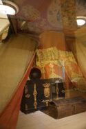
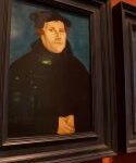
And the museums proper are well worth the visits. A new one for me was the German History Museum; the original building was the Prussian Arsenal, and given the size of Prussia’s armies, large enough to encompass a collection that starts in the late 700s, when Karl die Grosse, who you probably know better as Charlemagne, unified France and Germany, inaugurating the Holy Roman Empire with his coronation by the pope in Aux-la-Chapelle Christmas Day 800. The highlights of the collection for me were an extensive look at the man who brought reform to the church (Luther), and what is still the predominant religion (Lutheranism) to Germany; the hat and sword Napoleon left at Waterloo, fleeing when General Blucher, commanding the Prussian army, joined Wellington to turn the tide of battle; and—stunningly, a tent captured from the Ottomans at the siege of Vienna in 1683. The last-named item somehow found its way to Kaiser Wilhelm and thence into the collection at the Museum.
The Kaiser’s well-known end of the century flirtation with Sultan Abdul-Hamid, of Turkey, was a fatal dance politically, leading to the Ottoman’s joining (not entirely voluntarily) with the Central Powers, extending World War I to the Middle East and creating the chaos that endures till this day. I think this is around Anzac Day, an Australian-New Zeeland holiday that commemorates the bloody battles at Gallipoli.
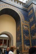
The flirtation had a more salutary effect (if you don’t mind that many of the artifacts wound up in Berlin) on archaeology; the Pergamon museum, even in its state of being rehabilitated, is stunning. When you go thru the gates of Ishtar, you’re transported to Scheherezade, with lions and other mosaics stretching for a block in the museum; a stunning partial fortress of some long-lost and otherwise forgotten caliph in the deserts; and a whole floor of Islamic Art that rivals anything in the world, with items from Istanbul, and Konya, and Agra, and Moorish Spain, and….The Neues Museum (mostly Egyptian) houses the famous Nefertiti bust, the Mona Lisa equivalent of the ancient world as the standard of beauty. No wonder we spent four and a half hours on the Museum Island at these two museums—and there were three more!
The archaeologists played an interesting part in the dance the Kaiser made that drew the Ottomans into the Central Powers. His goal during the war was to incite a jihad, especially against the British and French (can you say India? The Suez Canal? Lawrence of Arabia), which would have been quite a trick to make it national rather than religious. There’s an interesting book on the Berlin-Baghdad railroad, which was pivotal to the German war aims—and vital in bringing the artifacts back to Berlin.
We’re awaiting our flight home right now, which is to say, our plans are almost up in the air. Back home in “only” 18 hours-flight connections willing.

Ants and Virgins

Big bottomed ants, a virgin, and tropical dry forest add up to “the most beautiful city in Colombia”
January 6, 2018.
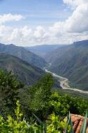
If you look at the CIA World Fact book, as I did, you’ll get an idea of the expanse of Colombia. Superimposing a Colombian map on the United States stretches the country the length of the Mississippi River, from Minneapolis to New Orleans. While we’ve sampled only a small part of it (we’re only 150 air miles from Bogota), but that includes a wide variety of habitats and a lot more than the 150 miles through the mountains. We’ve left the savanna behind in favor of high desert and canyons (and a 30 minute plane ride or 8 hour automobile ride back to Bogota, which says something about the transportation system. There are only a few “third generation” roads—six lane highways, and the road here, probably second generation, is a two-lane toll road that goes through every town, roughly following the ridges). As we’ve lost elevation, though still at around 4500 feet, we’ve passed through banana, orange, and coffee farms. The big product here, though, was tobacco.
Two things about that crop: first, it required sunshine, which mean most of the existing trees were cut down. The brochure on Barichara, where we’re staying in a charming boutique hotel, Moorish/Spanish style, says the tropical dry forest is the most endangered ecosystem of all, with only 2% remaining pristine. Tobacco and other agricultural pursuits have had a hand in that environmental change.
Second, the tobacco industry has declined, with the purchase of the local manufacturer by the British American Tobacco conglomerate. One result was a rather imaginative conversion of the old tobacco plant to a mall, with the foreman’s house converted to a museum. The exhausted tobacco lands need banned fertilizers to be productive again. The second-rate tobacco still produced here is for local consumption.
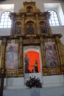
The current “cash crop,” however, is tourism, based around the 8000 population in Barichara. Legend has it that a peasant here around 1700 found a rock with the image of the Virgin, and convinced his friends to build a church, around which the town grew. The local clergy, however, condemned this as idolatry, destroyed the church, and built a “purified one” on the site in the mid 18th century. That church still stands, anchoring the square (which unlike Villa de Leyva has trees) that was and is the center of life in Spanish colonies.
The town is full of colonial and republican period homes, white adobe, housing the usual knick-knacks—like indigenous themed jewelry and textiles, specialty coffees and chocolates, restaurants and hotels. Eight thousand inhabitants live here, too. Surprisingly, you don’t see any modern construction in the city proper; the red tiles of the roofs and the hilly nature of the town provide part of the charm.
When we went for a walk to explore what there was, two visits stood out. One was a culture house, which local people created with a variety of gifts—art, cultural artifacts—and the docent who took us around shared a lot of information about the town.
The other visit was to the Paper Museum. It’s an NGO operation designed to provide gainful employment to women. The museum grows a variety of plants that can be turned into paper (did you know pineapple can be made into paper?), gives tours, and creates a variety of paper products for sale. I really liked the lampshades, but I’m certain I’d have shreds if I tried to bring one back.
The town overlooks a deep valley, and the upper part of the town is where one finds the inevitable Liberator statue. What I learned there is that the Boyaca battle ended the war for Colombian independence. There were battles fought to liberate the other countries (the five were Colombia, Bolivia, Ecuador, Peru, and Venezuela; I had listed Panama, but that country did not exist until Theodore Roosevelt helped convince revolutionaries there to separate it from Colombia around 1905 so the US could build the Panama Canal).
It was on that walk we purchased the fried big-bottomed ants that are considered a local delicacy. The “princesses” are captured as they attempt to fly out of the nest to start new colonies, deprived of wings, and roasted.
Supposedly, the ants date back to the indigenous Guane people who inhabited this area from about 1000 a.d. until they were assimilated (or annihilated) by the Spanish. Relatives of the Muisca, they were reputedly taller and lighter-skinned than their neighbors.
We learned more about the Guane today at a museum at what purported to be a National Park, which turned out to be a private park. Located at a breathtaking canyon that drops over 3000 feet (“Gran Canon” in local advertisements), the park had a water park, bungee jumping, a zip line, and the second longest cable car ride in the world. We took the last named, which dropped 2500 feet or so to the floor, then went up about 3500 feet to the other side, where we spent an hour wandering among the live traditional entertainers, local foods, and tchotchkes.
So if you want to eat ants (another local delicacy I tried was a mixture of goat intestines) and stay in what was voted the most beautiful old Spanish village in Colombia, you have to come to Barichara. Like we did.
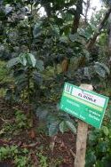
The next day—the ride to Bucaramanga duplicated part of the previous day’s ride through the mountains on a two-lane toll road, but detoured to visit a coffee farm The company, Hacienda de Roble, has been in business for over 150 years. Coffee grown for export has to meet strict standards. Like tobacco, certain soils and weather are important for growing the crop. A lesser brand, apparently not meeting global tastes, is sold locally. We got to taste four main varieties (there are over 300 different varieties of coffee), and I thought it was easier to tell the difference between the $5 Port and the $50 Port than to distinguish varieties of coffee, which can be even more costly than expensive Port. The farm has a garden with supposedly 72 varieties of coffee, mostly variants of Arabica (you can tell by the name it’s not native to Colombia), fertilized by chicken manure…..Ask for HR-61 if you want to try a coffee developed at the farm.
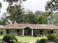
What impressed Carolyn was the Hacienda. Built by a woman artist in the 1860s, and now a boutique hotel, it’s in the Spanish colonial style. Set on the Mesa de los Santos, at roughly a mile high, the house would make for a comfortable stay. No wonder Carolyn said our next trip should be to visit other haciendas.
Time to go home to our own villa, though. No more mesas, mountains, or colonial villages. Sigh.

Villa de Leyva 2 January 4, 2018

January 4, 2018
Villa de Leyva (continued)
When we got to explore the city and the region, I found Villa all that I hoped it would be. The Plaza Mayor, the largest public square in Colombia (perhaps outside of Bogota), surrounded by cobblestone streets, and lovely old colonial architecture—the stucco with balconies or overhangs with arched walkways—looked like something out of a movie set (as indeed it has been featured in a number of movies and TV programs); we were lucky we got there early, when the square was relatively empty, and the tourists still recovering. We pretty much had the square to ourselves, and headed for the old colonial church that marks it; the church dates from the 16th century.
The area around Villa has been settled for a long time. The combination of salubrious weather, and enough water from the mountain run off, has made it a desirable location even before the wealthy from Bogota scouted it out for summer homes (some of which are truly palatial).
We set out to visit four tourist spots, ranging from several hundred million years ago to the present. Working from the ancient—this area was part of a sea as the great continent broke apart. That accounts for the minerals here (salt among others), and fossils. Hence, one of the places we went to was a fossil museum. The centerpiece was a complete fossilized skeleton of a 36 foot “baby” seagoing dinosaur, a Kronosaurus. I’m glad I met him in this state; his teeth showed no signs of decay (no sugar in his diet), and his crocodile head made it clear who would win that battle. Interestingly (to me anyway), our guide said there were no restrictions on taking fossils from the country; human artifacts, however, can get you in a world of trouble. Not enough room for any of the sauras in my suitcase, except maybe a theo.
Closer to the present (maybe 1300-1500), I’ve mentioned the Muisca before, and they were here too. There are two sites locally—another lake (where humanity began)—but we went to an astronomical observatory. It’s fascinating how various peoples who depended on agriculture figured out how to take advantage of weather or predict it. From Cahokia to Stonehenge to the Temple of Heaven in China, they found a way to determine the solstices and the equinox. Here, there were lines of stones running east to west, and when the sun cast shadows in the right places, people knew it was time to plant or to harvest. That information kept emperors in power in China (if nature cooperated). The grounds also contained a tomb of a prominent woman (Muisca were matrilineal) with four men. Unfortunately for posterity, the tomb was looted, so only bones were left—and the buried tomb was on a north-south axis).
Third tour spot was a former Dominican monastery. It had been overrun by armies since Independence, and fell into disuse, but is now a museum, and well preserved. What I appreciated most about it was the information was in three languages—Spanish, English, and French (French?), and was pretty basic about what had been the purpose of the rooms.
Taking us to the present was a visit to a vineyard. Chile is the South American standard for wines, and when I saw the empty bottles had all come on pallets from Chile, I knew that this was primarily for tourists. The wine is distributed locally, but I had no desire to bring the first (and probably only) bottle of it back to Bloomington-Normal.
When we came back to the Bell Tower Inn where we are staying, I went back to the square. One of the museums I wanted to see was dedicated to religious art, and another museum was residence and collection of Luis Acuna, a prominent 20th century artist. I liked both the artist’s house and his paintings, which were part of the Bachue movement. He incorporated a lot of local themes in his art, including a mural depicting the origin of the human race a la Muisca. The explanation takes about half the brochure for the museum, which is to say it’s a large and complex story, and a large and complex mural.
Withal, an interesting day in Villa de Leyva.

Villa De Leyva (1)

Villa de Leyva January 3, 2018
The trip to this city took root over a year ago when, in Cartagena, I read in the Lonely Planet guidebook that Villa de Leyva was one of the best preserved colonial cities in South America. That and about $5 leftover Colombian pesos closed the deal for me.
It’s day three of our trip to inland Colombia, but we just arrived here in Villa de Leyva a few hours ago, having flown to Bogota and spent two nights there. A few observations on that capital city—of 7-10 million people on the savannah de Bacata, a plateau in the Andes that stretches several hundred miles (Bogota is at 4 degrees, 37 minutes north of the equator, at 8600 feet). The climate in Bogota is almost always the same, we were told; 66 during the day, 45 at night—only about a 75 degree difference from this week in Bloomington. That difference (the 10 degrees below in Bloomington) nearly cut short our trip by a day, since when we got to the airport Monday afternoon, I saw the dreaded “flight delayed” on the board, and a “We’ll do our best to reschedule your affected flights” email message. Fortunately for us, that delay coincided with a delay in Atlanta, which got us into Bogota on time.We spent a full day in Bogota, and a full day getting to Villa, and here’s a few thoughts to share:

1) The pre-Colombian past lives not just in museums, but in some of the ways Colombia has addressed its indigenous population—rather like the Canadians have (recently) discussed and treated the first nation. The biggest local tribe, the Muisca, has recently been reorganized, and one of the visits (a 2 mile hike to a sacred lake—at 10000 feet) was on tribal land. Our guide told us that the history of the country has been rewritten to separate the arrival of the Europeans from the arrival of the first nations. The Muisca in particular had a reverence for the outdoors, especially the sun, earth, moon, and water. In Bogota, one of the first things we did was take a funicular ride up to almost 9000 feet for an overlook of the city. This mountain was sacred, and represented the sun. Of course, because it was sacred to the Muisca, the Spanish,

Sacred lake

who killed the last king of the tribe in the 16th century, built a church on it, and did the same on a neighboring hill, representing the moon.

The Muisca “coronated” kings in few area lakes (depending on the branch of the tribe). As I said, we went to one, which had a ceremonial house where the new king prepared for his “anointment” in the lake. On the specific day, he would go out on the water, and to give thanks for his people, deposit gold and emeralds (still two objects mined or found in Colombia) into the lake. Archeologists count 48 kings who went through the ceremony.

Being into shiny was one of the reasons for the Spanish conquest; the lake gave rise to the myth of an El Dorado of riches, but subsequent generations also sought the wealth supposedly beneath the waters. The Spanish tried in vain to drain the lake, as did more contemporary engineers. The government finally stepped in to preserve the lake, and entrance is now monitored and restricted.

The most impressive museum in Bogota (a city of contrasts; from the peak the guide showed us the old city, the centro, and the north—the economically well off; and then the south, which even from 9200 feet looked like favelas I’ve seen in Brazil and Chile, and townships in South Africa) housed the gold treasurers that attracted the Spanish.

2) One of the consequences of Spanish rule is that Colombia is predominantly Catholic, and that’s reflected in a number of the churches we saw in Bogota, and on the way to Villa. The older churches in the capital reflect the wealth of the Church (the independence movement was not anti-clerical; that came much later), including several whose baroque interiors were byproducts of the wealth the new world gave to the old. Perhaps the most striking, however, was the “Cathedral of Salt.” Its origins were in the shrine at which miners prayed before going into the salt mines, or returned from them, thankful of surviving. When the original flooded in the 1990s, miners built a bigger one that was voted the “Number 1 Marvel in Colombia.” All underground, the entrance to the cathedral is via the Stations of the Cross, which ushers into a huge vaulted room that Pope Francis visited last year.

3) Colombian history has been politically troubled for hundreds of years. Bogota owes its settlement partly to the fertile savannah, but partly to the fact that it wasn’t on the ocean; the wealth of Cartagena of the Indies attracted pirates and the Dutch, French, and English who saw looting as a short cut to riches.The turbulence in 20th century Colombia has contributed to the paucity of colonial-era buildings in Bogota. In 1948, a left-leaning presidential candidate was assassinated (think CIA?), which led to riots resulting in hundreds of homes being burned, and thousands of people killed. More recently, in the 1990s, one of the militant parties (the recent truce lured the FARC into running for government in return for turning in their arms; FARC was the last major anti-government force) seized the Judiciary building, along with hostages. The army besieged the building, with over 100 dead, including most judges, and the building had to be replaced.

Not all the violence has been counterproductive, and it has been interesting to follow the career of “The Liberator,” Simon Bolivar. I saw

Bolivar’s House in Bogota

where he died, in Santa Marta, last year. This time, we visited the Quinta de Bolivar, a house given to him, whichSword of the Liberator contained a replica of his sword (the M-19, one of the anti-government groups stole it in the 90s, and the recovered original is in the archives; a copy is in the Quinta).

While the center of Bogota is the Plaza de Bolivar, perhaps the most moving place for me was on our way here—the site of the Battle of Boyaca. Fought on August 7, 1819, it marked the end of the war for Independence.

Boyaca and Bolivar

Colombia  was the result of an almost a 10 year war, one that began in Bogota

Broken vase which led to independence

supposedly when a pure-blood Spaniard refused to give a vase to a Colombian-born Spaniard (such were the distinctions made in 1810 when the government in exile—Napoleon’s brother was elevated to the throne–tried to rule the new world). The broken vase supposedly ignited the revolution; it’s in the museum of independence which I also visited.

The political structure that Bolivar sought to build—rather like the European union of the five countries—collapsed in the politics and past history and personalities of his generals and the countries concerned. Colombia itself has had trouble balancing centralization and federalism. Villa de Leyva faces the geographical diversity that is Colombia—forest, jungle, desert, etc. I look forward to seeing it in daylight. That’s for tomorrow.

How to Spend One Day in Florence, but Don’t Try This At Home

August 22, 2017

With only one day, I had to plan carefully to get my ration of churches, forts, palaces—and here, Renaissance art museums.

I’m happy to say that, despite the challenges of being one among 22 million, I was reasonably successful.

The morning began with a local guide taking us past the highlights: the Duomo, the Medici palaces (two of them), the ancient bridge (14th century) still used today.  When the Medicis moved across the river, they changed the use of the bridge; previously it housed all kinds of vendors. The family objected to the smells of rotting meat, and so ordered the bridge to be used only by jewelers.  “Gold smells good,” someone quipped.

The tour took us past the religious center (the Duomo is larger than the one in Siena, which it resembles in the white and green striped marble). The Duomo can accommodate 30,000 worshippers, but had a hard time accommodating the 30,000 tourists, who wanted to take advantage of one of the few free attractions in the city. It’s also the burial place of Michelangelo, who put Florence (and later the Vatican) on the art map.  He’s standing in front of the town hall, or at least a copy of his famous statue of David is.

She explained that the history of the Renaissance is largely tied up with the Medici family, which ruled Florence until the last family member died in the 1740s, and the area became part of the Duchy of Tuscany. The Medicis were sponsors of the arts, and Michelangelo lived in their palace and was schooled with their sons from the age of 9 until 17. Thereafter, he completed many projects (i.e., was paid) until the Medicis got too powerful and were overthrown briefly.  He never made peace with the family, and went to Rome, where he spent 30 years painting the Sistine Chapel.  The Medicis brought his body back, though, for a funeral in Florence.

Medici Library

With that background, I decided that with only one day, I would try to concentrate on the Medicis (who could resist Lorenzo the Magnificent?) and Michelangelo.  I fear I scratched the surface, given the surfeit of palaces and works associated with two of Florence’s major citizens.

I went to the first (of three) Medici palaces, and realized that the family had good taste and funds.  They were not nobles, but traded money for favors from royalty.  One such trade brought them the right to use the fleur de lis (the Bourbon sign) which is now part of the logo for Florence (along with the iris, which is a legacy of the Roman founders; Florence comes from flora).  The other directly Medici buildings I saw came from their piety.  They wanted to build a chapel and literally built a chapel and a church, both stunning works of art.  The chapel has the family tombs. The church, named for St. Lawrence, was designed by Michelangelo, but when he broke with the family, he refused to finish the façade. The unfinished outside hides another stunning interior, with paintings from the Renaissance masters, and pulpits by the well-known sculptor, Donatello, who is buried in the crypt.

Carolyn insisted on seeing the real statue of David, not the copy that is in the square.  That took us to the Academy, a building erected especially to house the statue (it’s about 20 feet tall), and is the most famous item in the building.

Michelangelo The Holy Family

That left the Uffizi, once the offices of the Medici government, now turned into one of the great art museums, based at least originally on the holdings of the family. Well-known paintings mostly from the Renaissance abound; there’s four rooms of Botticelli, for example. Two hours was almost enough to see just the highlights.

Not a bad day’s sightseeing—for the last day of our Malta/Italy trip.