Mum’s the word
May 12, 2019 Livingstone, Zambia
If you’re looking for a way to impress Mum on Mother’s Day, here’s what worked well for me today:
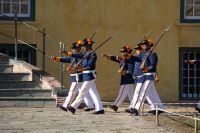
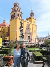
First, select a four-star resort in an exotic location. Say, Zambia, a country of 16 million people, with 72 languages, 11 of which are considered major enough to be province specific and taught in the schools. Studies indicated students achieved more if taught in the local languages than in English (at least through high school). Check.
 Second, it helps if the resort is in the midst of one of the seven wonders of the natural world. I think there must be hundreds of top seven, like Thunder in the Smoke Falls (the original name before Livingstone honored his queen and they became Victoria Falls). Check.
Third, make sure the resort offers an interesting variety of optional activities (other than the usual Olympic-sized swimming pool, superb dining room, and bedrooms with mosquito netting and other exotic indications that you are in the tropics). These options could include:
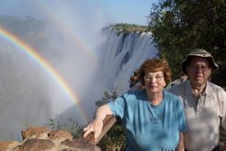
1) A private tour of Victoria Falls, along a part of the trail that’s handicapped 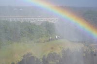 accessible and dry, in case she’s concerned about having wet hair. Be sure it is early enough in the day to boast multiple rainbows. That makes for neater pictures, along with the mist (smoke) and roar (thunder). Check.
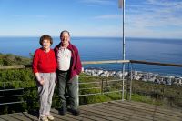
2) A view of the falls from above is a must, whether it’s an ultralight (I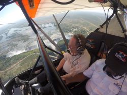 personally recommend), a helicopter, or, for the risk takers, a multilight flight. You can’t take a camera with you for the ultras or the multis, but a go pro takes pictures every ten seconds, and you can buy that as a once-in-a-lifetime gift. It’s an added benefit if the pilot drops down over the national park to show you the endangered white rhino or a herd of elephants. An admission: I took that ultralight flight, to Carolyn’s dismay. Check.
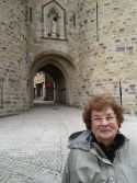
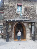
 3) It’s a long walk to Zimbabwe, which shares the falls with Zambia, an extra visa, and an extra charge for admission to the Zimbabwe side, but you do have the opportunity of getting another stamp on your passport, a walk across a bridge that was originally part of the vision Cecil John Rhodes had for a Cape-to-Cairo railroad (and now in addition the site of a bungee jumping station). The Zimbabwe side has the deeper channel, with most of the water all year round. In May, the beginning of winter, the falls are almost at their peak, so it’s not essential to go to the other side. It does, however, offer access to the town of Victoria Falls, which has a wonderfully luxurious colonial hotel. Check.
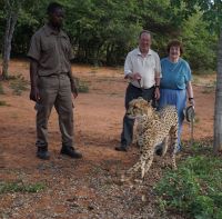 4) Fourth, there should be a lot of nature walks—a safari, a boat safari, a lion walk (they’re fed and tame), an elephant ride, and a walk with cheetahs, which can be lovable cats, we learned, if they’re born in captivity and well fed before you arrive (about 10 pounds of meat a day). Check.

5) Fifth, a sunset cruise on the Zambezi River (almost 2000 miles, but we did not do that much of it), or a canoe/kayak trip, doing your best to avoid the most dangerous animal—the hippopotamus, while enjoying that floating submarine from a safe distance. (and you doubt it when I write that tourism is the world’s biggest business). Check.
Finally, top off the day with a dinner at the five-star sister resort, the Royal Livingstone, whose dishes include venison (it’s a kudu, we were told)—and you can sample some local dishes, including worms, which some of our faculty did. (Incidentally, they were ok). Check.
And if you stick around for a few days (we’re leaving for Botswana tomorrow), you’ll eventually learn why it took so long to find Livingstone; I’ve been asking for Dr. Livingston, and, as you clever readers have discovered, it’s spelled with an “e”. He’s now commemorated as one of the few colonial heroes with a statue on both sides of the border, and spelled with an “e.” Check.
Hope you’re mum’s day was as pleasant as ours.