We’re at the limits of the European Union—in more ways than one. We arrived yesterday (though it seems longer ago) in Athens, 1100 miles from  Berlin, via Warsaw on Lot Airlines—no doubt an event to be celebrated. We’re in the city with 5 million people, and it’s easy to talk about the birth of democracy. It happened here, and we’ve seen the love affair that Europe has had with Greece reflected in the museums in London, Paris, and Berlin. The independence of Greece from Turkey, in the 1820s, was partly Europe’s payback for that love affair.
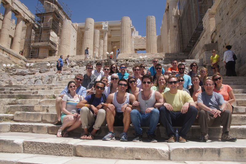
The heyday though (and Greece continues to cash in on it) was the Golden Age. Flush with its victories over the Persians in the 5th century, Pericles 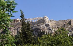 and his cohorts constructed on the Acropolis a literal “city on a hill” that has become the second most-desired site to see in the world (second to Angkor Wat). We visited the Acropolis this afternoon as part of our city-of-Athens tour, and really the major highlight of it. Perched atop the highest flat hill in Athens, the Greeks built temples to the main gods of the city, Athena (who supposedly gave the city olive trees), and Poseidon, who was the lord of the seas.
What remains from 2500 years of wars, Christianity, Islam, and pollution is still impressive. The Parthenon, the virgin Athena’s apartment, with its 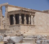 massive Doric pillars; the second temple to
  Poseidon and Athena has the Caryatids that support the roof, rather like the Museum of Science and Industry in Chicago. There’s also a temple to Athena Nike (victory) and another smaller temple at the entrance. The Acropolis was used by the Greeks, the Romans, then converted to a Church when the empire went Christian, then converted to a Mosque when the Turks conquered Greece, then reconverted to the Acropolis. One of the features we noted in London was the “Elgin Marbles” (saved from pollution and depredation, says the British Museum; stolen illegally, say the Greeks), the friezes that make up the story of the procession of Athena on the frieze at the Parthenon.
That was part of our city tour, though there really isn’t a lot to see in Athens; there’s a lot of temples from Greek and Roman days–the Romans adored Greek civilization, and helped spread it throughout the West. The 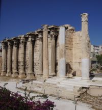 emperor Hadrian (2nd century) had a special place for Athens, completing the Temple of Zeus, begun 5 centuries earlier and a triumphal arch, etc. Athens, unlike Rome, wasn’t really the center of an Empire. Rather, our guide’s family background exemplifies the spread of Greek civilization; one parent has roots in Istanbul (Constantinople) and the other in Smyrna (Izmir in Turkey). Greek colonies dotted the eastern Mediterranean and the former Byzantine empire, lasting really until Ataturk in the 1920s fought to preserve and define a Turkish state that resulted in massive population movements of Greeks to Greece and Turks to Turkey.
We had about two hours of free time which I used to do what I love to do—wander aimlessly, exploring. It gave me a new sense of ancient Greece 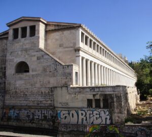 because I went to areas that I’d never been before, which are not really accessible by bus. The area is Monastiraki, an old monastery area at the base of the Acropolis, that is really the old town. One after another sights—the Roman baths, the library of Hadrian, the Tower of the Winds—all part of the ancient city artifacts, and all closed as of 3 pm. Can you believe that? Only one museum in the city is open after 3 pm….
The other question was partially settled at our visit to PWC (no, not with an alum, but set up by Jim Majernick, with Price Waterhouse Cooper, who was a student on one May term trip in 2001 which went around the world—and I’m glad I kept in touch with him). PWC is a global accounting firm, which gave us an introduction to both Greece and the company. There’s no doubt that Greece is one of the problem children in the European Union. The  unemployment rate is staggering—almost 30 per cent in the country, and over 60 percent among people under 24. Even the optimistic folks at PWC admitted that Greeks have lived beyond their means, and needed some of the discipline imposed on the country as the price for the bailout funds that have kept it afloat. They were quick to note, however, that the press, especially CNN, has sensationalized the protests in Greece, hiring someone to launch tear gas for better pictures and a better story.
Whatever the truth (and we’re not going to Delphi for the oracle to predict the future or even give us a reading on the present), it’s pretty obvious that the EU is not the United States. The cultures, languages, histories, economies, are speed bumps in a flat world. Economically, for example, of the 27 countries, 17 use the Euro, which means that there is one monetary policy for 17 countries, and 17 fiscal policies for those countries, not to mention the other ten. I think the folks in Brussels who called it an “unprecedented experiment” and “a work in progress” may have described it best. It’s too entangled to be untangled easily.
We mused about this on our way to having dinner on the Saronic Gulf, watching the sunset over the ocean. I must say that the Olympics (we visited the 1896 site and passed by the 2004 village) in 2004 gave Greece a great public infrastructure, with a clean subway, but contributed part of the debt that, in the days of easy money, made everyone happy in the European Union. It’s pretty obvious we tourists are now among the happiest people in the European Union. Dining on saganaki and mousaka certainly helped.
Tomorrow we visit places that predate the golden age of Greece.
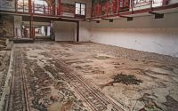 invariably find something they need to excavate before they build. That was the case when they discovered the floor of the great palace which had housed the Byzantine rulers. The mosaic covers about 200 feet, and is one of the largest in the world, as befits one of the largest empires in the world.
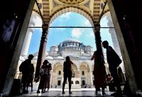 Suleyman the Magnificent, the Sultan who brought Islam into central Europe, being turned back (by rain and snow, said our guide) only at the gates of Vienna, by a combined European force (that was a good application of the European Union!) when the Polish army under Jon III Sobieski turned up in the nick of
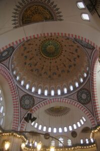 time. Plus, the architect of the mosque was the famous Sinan, and I wanted to be sure to see one of his monumental buildings.
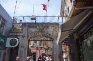 conquest institution, a covered market of 4,000 shops that would do China proud—everything from copperware to clothes, utensils to jewelry—low to high prices. The streets were pretty crowded with shoppers and tourists (sometimes one and the same), but every so often would be a gem—the
 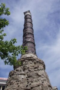 column Constantine brought to Constantinople that once stood in front of the Temple of Apollo at Delphi; Istanbul university, with its combination of classical/Islamic/modern buildings; and tombs of the former Sultans, including Bayazit, the second emperor, who sent his fleet to Barcelona in 1492 to bring Jewish refugees from the expulsion in Spain to the Ottoman Empire, and the late 19th century sultan who courted (and was courted by) Kaiser Wilhelm, whose gift of a fountain is still on the tour routes—especially for German visitors. But not this year. The fountain was being renovated.
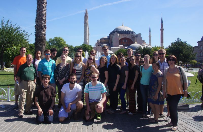
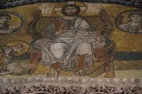
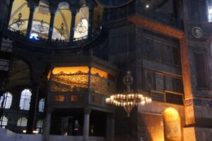 During the Republic, Ataturk turned it into a museum, partially Christian, partially Muslim. Some of the mosaics survived, but so did the mihrab and the camel skin panels praising Mohammed and Allah. It remains, for me, one of the most impressive sights in Istanbul, partly for what it has meant over time. When you come to see it, it may have more of its original features; about half the building now is being renovated.
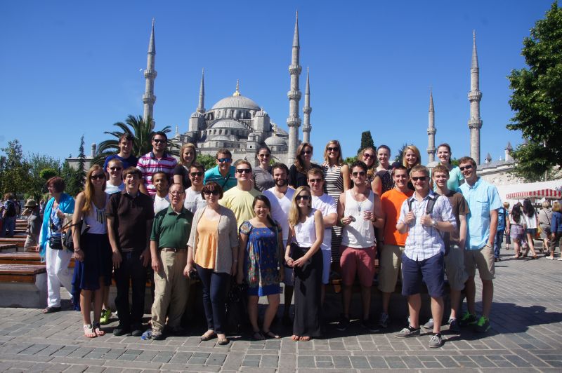 century. Western guidebooks usually call it the Blue Mosque because ofthe plethora of blue tiles in the stunning inside, but it’s really the mosque one of the sultans commissioned to be built (as our guide said most mosques were) in 7 years. Indeed, the sultan ordered the mosque to have 6 prayer towers (minarets), because, at the time, only the mosque in Mecca had 6 minarets; most have only four, but the sultan of Turkey, Defender of the Faith, was, I think, at the time the overlord of Saudi Arabia, and wanted to demonstrate his authority. Enraged conservatives added three minarets, and now the mosque in Mecca has nine, but the Blue Mosque is the only one with 6.
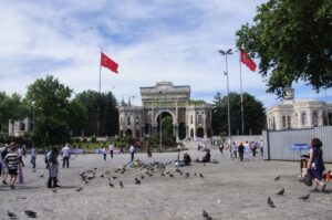 Not many noticed it, and our guide did not point it out, but connecting the two religious institutions was what had been the center of Byzantine social life, the Hippodrome. At one time, it could seat 100,000 people, and was THE place for the Reds, Greens, and Blues and Whites to cheer on their teams, much as soccer fans still do today. There’s not much left from the Byzantine days, save for a few obelisks (the Romans brought them to Rome, too).
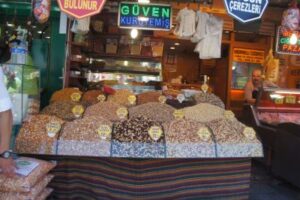 The other site was a visit to a 15th century business location, the so-called “Spice Market,” where merchants from Egypt and other exotic places brought their saffrons, teas, and other foodstuffs that makes Istanbul a far more interesting place for me to eat than, say, London. This was where I parted company with the group and began my own “free for all,” because there were a few places I thought I would hit because they were not on my after-trip itinerary.
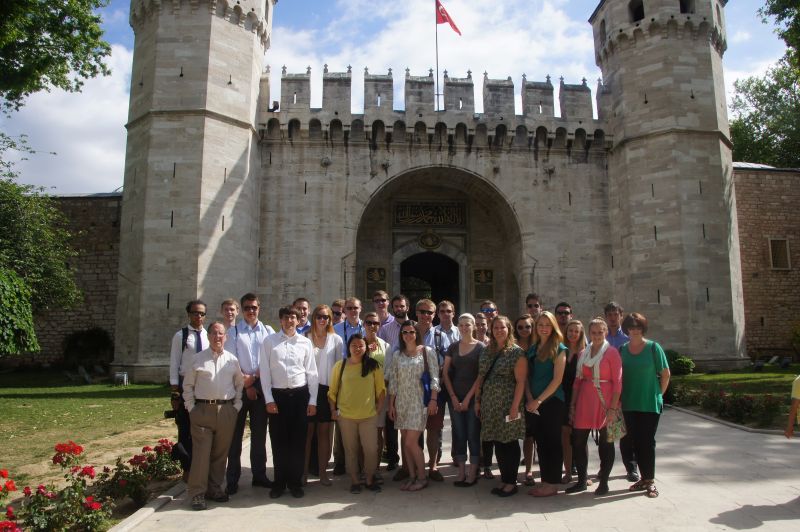 the 36 Sultans of the Ottoman Empire (1453-1923, though the family moved in the late 18th century to a more European palace in another part of the city). Having been to Windsor Castle, Versailles, and Potsdam, we’ve seen Western European castles and palaces. No one, however, except me, had seen the palaces in India (the Moghul forts at New Delhi and Agra) that are the closest equivalent of Topkapi—with the open pavilions, the gold and tile floral decorations—etc., that make me think of Scheherazade).
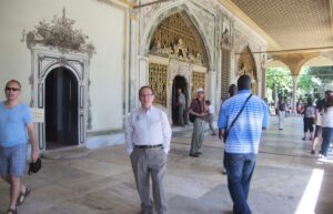 artefacts that are stunning—diamonds, jade, jewels—and the Peacock throne, which a Persian army looted from New Delhi, and the Ottomans took from Persia. The religious relics included the sword of David, the staff of Moses, an arm and jawbone of St. John the Baptist—and hair from the beard of Mohammed, his footsteps, his sword—all reminders that at one time, the Ottomans conquered the Holy Lands (Mecca and Jerusalem), and the Caliphate was in effect the “pope” of the Muslim world. I think one of the many titles of the sultan was Defender of the Faith. Expanded over the years, Topkapi became the second largest palace complex over the years—second to the Forbidden City. Ataturk turned it into a museum in the 1920s.
 2008—but now are not so sure. The company itself has numerous projects and holdings, few of them in Europe, and most of them trading regionally (Russia and the nation of Georgia) or Muslim countries, like the UAE, Algeria, and Malaysia.
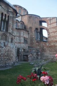
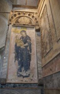
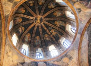 The ceilings are literally covered with the story of Jesus and Mary, the gift of a city official in the 14th century, which saw a renaissance (our guide used the word, and said that the “Renaissance” began in Byzantium before it spread to Western
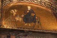
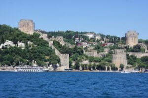 Spain, and the physicians to the Sultans were usually Jewish), it’s sometimes difficult to remember how rich the country was—though it is easily remembered how powerful it was. Suleyman’s defeat at the gates of Vienna marked the westward limits of Turkish conquests, but I’ve seen battlefields in Poland and Russia, and indications of the occupation of the Balkans, Greece, and Hungary that are neither forgotten nor forgiven. We will be seeing the Topkapi Palace tomorrow, which should give our students some insight into what being rich meant in the 16th and 17th centuries. It helped Professor Pana and I to understand it when we went to a “traditional restaurant” whose recipes were based on the cookbook of Mehmet II. As we sat in the shadow of Hagia Sophia, we ate like a king for a night. We’ve set up a “farewell dinner” in a similar restaurant tomorrow, near the Chora Church with its world famous mosaics.
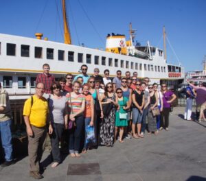 ride to the Black Sea.
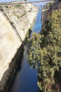 Acropolis, reflecting the civilization of the Mycenaean period, the other, a third century theater, paired with Greek medicine, that today has acoustics and seating for 14,000 that still draw entertainment from performances of Aeschylus to symphony orchestras, with acoustics at the top as clear as at the bottom—and no electronic magnification.
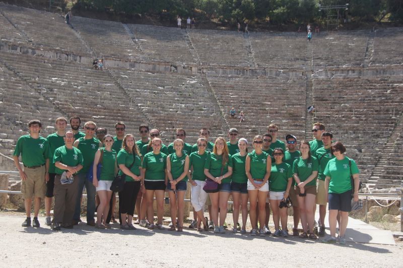 The theater is stunning, set in pines in the mountains, but its origins were to celebrate the god of healing, Asclepius. The Greeks had developed medicinal practices, ultimately ordered by Hippocrates (in the Hippocratic Oath that doctors still take today), that included therapies borrowed from Egypt, and home-grown therapies such as shock treatments (putting people in with snakes)! I’ve seen a similar complex in Pergamon, which apparently rivaled Epidavros, but today, what’s left at Epidavros is the theater.
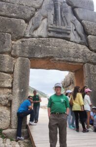 pure fiction, the current thinking is that Agamemnon was a real king, but the “mask of Agamemnon,” one of the most famous pieces in the National Archeological Museum (did I tell you they close all museums save the Acropolis museum at 3 pm to save money) is about 300 years off. We saw
  the citadel on the acropolis, distinguished by a double lion gate, and the beehive shaped tomb where Schliemann found the mask. We also saw ruins of many other citadels, proving that Greece had both civil wars (the Peloponnesian War marked the end of the ascendancy of Athens) and wars with the Persians, and later others, including the Turks, who conquered the country shortly after the fall of Constantinople, and the Venetians, among others.
 Berlin, via Warsaw on Lot Airlines—no doubt an event to be celebrated. We’re in the city with 5 million people, and it’s easy to talk about the birth of democracy. It happened here, and we’ve seen the love affair that Europe has had with Greece reflected in the museums in London, Paris, and Berlin. The independence of Greece from Turkey, in the 1820s, was partly Europe’s payback for that love affair.
 and his cohorts constructed on the Acropolis a literal “city on a hill” that has become the second most-desired site to see in the world (second to Angkor Wat). We visited the Acropolis this afternoon as part of our city-of-Athens tour, and really the major highlight of it. Perched atop the highest flat hill in Athens, the Greeks built temples to the main gods of the city, Athena (who supposedly gave the city olive trees), and Poseidon, who was the lord of the seas.
 Poseidon and Athena has the Caryatids that support the roof, rather like the Museum of Science and Industry in Chicago. There’s also a temple to Athena Nike (victory) and another smaller temple at the entrance. The Acropolis was used by the Greeks, the Romans, then converted to a Church when the empire went Christian, then converted to a Mosque when the Turks conquered Greece, then reconverted to the Acropolis. One of the features we noted in London was the “Elgin Marbles” (saved from pollution and depredation, says the British Museum; stolen illegally, say the Greeks), the friezes that make up the story of the procession of Athena on the frieze at the Parthenon.
 because I went to areas that I’d never been before, which are not really accessible by bus. The area is Monastiraki, an old monastery area at the base of the Acropolis, that is really the old town. One after another sights—the Roman baths, the library of Hadrian, the Tower of the Winds—all part of the ancient city artifacts, and all closed as of 3 pm. Can you believe that? Only one museum in the city is open after 3 pm….
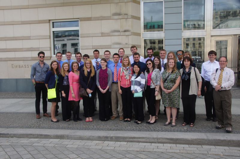 The political and economic officers, for example, mentioned that Germany has asserted leadership, both within the European Union and also on behalf of the European Union in world politics—it’s got a number of troops supporting US efforts in the Middle East, for example. German support for the government’s handling of the economy registers in the 70%, while Europe as a whole averages under 10. Even the support of Germans for the efforts to prop up the Euro are applauded—provided the mechanisms for responsibility and accountability are put in place. Germans do not generally accept debt as readily as Americans do—the German word for guilt is identical to the word for debt, he stated, and was one reason Germany did not get burned as badly as the US did in 2008; another is that the economy is still weighted toward industry, rather than services. He also pointed out that Germany has become a bigger economic trading partner with the Chinese, something I’ve seen on my trips to China. Germany has benefitted from both travel (2 million Germans get US visas; 1 million Americans reciprocate), and, with the lowest birth rate in Europe, from immigration; 20% of Germans are “first generation.”

 Germany for the Netherlands, and is buried there.